Conquer Club

[Official] British Isles REVAMP [Quenched]

Care to peruse completed maps? Take a stroll through the Atlas.

Moderator: Cartographers

Forum rules
Please read the Community Guidelines before posting.

Postby wicked on Thu Jan 03, 2008 8:23 am

The mountains do look kinda just thrown in there last minute. I think that's how my 7 y.o. nephew would draw them. There's definitely room for improvement.

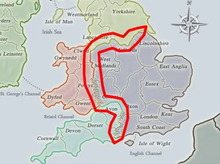
Also, can you move over these names to center them in the territory more? Gloucs., Essex, Oxon, Lincolnshire, West Midlands.

Your name/number locations for Strathclyde are different on the small and large maps. Use what you did for the small for both - it looks better.

There's water texture? Where? :shock:

I know it's called Lothian & Borders.... but you're telling me if I told an Englishman Lothian, he wouldn't know where I was talking about? Come on now. There's already a Borders in Ireland... switch L&B to just Lothian.

And it's never too late for comments. This map isn't done yet.
User avatar
Major wicked
 
Posts: 15787
Joined: Thu Jan 26, 2006 1:23 pm

Postby MrBenn on Thu Jan 03, 2008 9:31 am

gimil wrote:The mountians have been passed and accepted by discussing already.


There may have been some discussion about stretching/sizing the mountains on the Welsh border, but I've just read everything from my last post (on p16), and the only comment about the mountains is one from me,with a suggestion about changing the mountains in the South to be the New Forest...

There haven't been any comments about the visual impact of the mountains... I don't have any particular problems with the way the mountains look, but there are others who do...

Discuss... :wink:
User avatar
Lieutenant MrBenn
 
Posts: 6880
Joined: Wed Nov 21, 2007 9:32 am
Location: Off Duty

Postby gimil on Thu Jan 03, 2008 9:33 am

changing to a forest? must of been a comment i missed ill look into it :)
What do you know about map making, bitch?

natty_dread wrote:I was wrong


Top Score:2403
User avatar
Corporal 1st Class gimil
 
Posts: 8599
Joined: Sat Mar 03, 2007 12:42 pm
Location: United Kingdom (Scotland)

Postby Jesse710 on Thu Jan 03, 2008 10:15 am

gimil wrote:
Jesse710 wrote:Is the map going to have the country flag's in the background like your other image?


nope there was a strong disagreement towards them from thw commumity so they went :(


I'd say it looked a lot cooler with them
Image
Corporal Jesse710
 
Posts: 406
Joined: Sat Sep 01, 2007 8:00 am
Location: Candy Mountain

Postby MrBenn on Thu Jan 03, 2008 4:01 pm

There were issues with the flags/countries... ie England has 1 flag, but covers 3 'continents'; which made it a little confusing for the eye.

There was also a big hoo-haa about the N Ireland flag, for reasons that are a bit beyond me (they don't currently have an official flag - and the generally recognised one (ie their old flag) has various political connotations which is why it is no longer used )...
User avatar
Lieutenant MrBenn
 
Posts: 6880
Joined: Wed Nov 21, 2007 9:32 am
Location: Off Duty

Postby gimil on Thu Jan 03, 2008 4:01 pm

MrBenn wrote:There were issues with the flags/countries... ie England has 1 flag, but covers 3 'continents'; which made it a little confusing for the eye.

There was also a big hoo-haa about the N Ireland flag, for reasons that are a bit beyond me (they don't currently have an official flag - and the generally recognised one (ie their old flag) has various political connotations which is why it is no longer used )...


long story short the flags became a no-no
What do you know about map making, bitch?

natty_dread wrote:I was wrong


Top Score:2403
User avatar
Corporal 1st Class gimil
 
Posts: 8599
Joined: Sat Mar 03, 2007 12:42 pm
Location: United Kingdom (Scotland)

Postby rebelman on Thu Jan 03, 2008 4:29 pm

I it possible to make the Irish "borders" "border counties" instead as that is what they are actually known as
Don't now why people on here don't like being cooks, remember under siege: A former SEAL, now cook, is the only person who can stop a gang of terrorists when they sieze control of a US Navy battleship.
User avatar
Private rebelman
 
Posts: 2968
Joined: Thu Aug 02, 2007 5:24 pm
Location: People's Republic of Cork

Postby iancanton on Sat Jan 05, 2008 12:36 pm

Incandenza wrote:the lake in Northern Ireland seems extraneous.


our map currently shows two lakes in northern ireland.

the larger one is lough neagh, which is an instantly-recognisable feature of any northern ireland map. like lake winnipeg on the canada map, it doesn't have any part in the gameplay, although it serves as a landmark.

the smaller one on the right is strangford lough, which is supposed to have an outlet to the sea at its south-east corner (and therefore isn't actually a lake). can we redraw the irish coastline at strangford lough to reflect this?

http://www.strangfordlough.org/map/context.htm

ian. :)
User avatar
Brigadier iancanton
Foundry Foreman
Foundry Foreman
 
Posts: 2436
Joined: Fri Jun 01, 2007 5:40 am
Location: europe

Postby bonobo`s son on Sun Jan 06, 2008 1:35 pm

the colors of the map playable now is much better then this one
ImageImage
Major bonobo`s son
 
Posts: 420
Joined: Thu Jan 04, 2007 11:27 am
Location: Amsterdam - Artis

Postby pepperonibread on Sun Jan 06, 2008 1:43 pm

South England doesn't have a full dark border like the rest of the continents, just a minor problem. If it looks like you'll have to redo a lot of borders to fix it, I say don't bother with it.
Image
User avatar
Corporal pepperonibread
 
Posts: 954
Joined: Sun Jan 28, 2007 4:33 pm
Location: The Former Confederacy

Postby bonobo`s son on Sun Jan 06, 2008 2:00 pm

pepperonibread wrote:South England doesn't have a full dark border like the rest of the continents, just a minor problem. If it looks like you'll have to redo a lot of borders to fix it, I say don't bother with it.
because of those things the netherlands isn't quenched so it is a problem what got to be done before quenching.
ImageImage
Major bonobo`s son
 
Posts: 420
Joined: Thu Jan 04, 2007 11:27 am
Location: Amsterdam - Artis

Postby gimil on Sun Jan 06, 2008 2:17 pm

bonobo`s son wrote:
pepperonibread wrote:South England doesn't have a full dark border like the rest of the continents, just a minor problem. If it looks like you'll have to redo a lot of borders to fix it, I say don't bother with it.
because of those things the netherlands isn't quenched so it is a problem what got to be done before quenching.


Netherlands concerns are becasue they can disrupt gameplay and potentially reduce players enjoyment. THese ones dont.

However, as always i will see what i can do, but pep i dont see what your talking about. Can you circles where your concerns lie?
What do you know about map making, bitch?

natty_dread wrote:I was wrong


Top Score:2403
User avatar
Corporal 1st Class gimil
 
Posts: 8599
Joined: Sat Mar 03, 2007 12:42 pm
Location: United Kingdom (Scotland)

Postby bonobo`s son on Sun Jan 06, 2008 2:45 pm

gimil wrote:
bonobo`s son wrote:
pepperonibread wrote:South England doesn't have a full dark border like the rest of the continents, just a minor problem. If it looks like you'll have to redo a lot of borders to fix it, I say don't bother with it.
because of those things the netherlands isn't quenched so it is a problem what got to be done before quenching.


Netherlands concerns are becasue they can disrupt gameplay and potentially reduce players enjoyment. THese ones dont.

However, as always i will see what i can do, but pep i dont see what your talking about. Can you circles where your concerns lie?
this won`t help gameplay only graphics
ImageImage
Major bonobo`s son
 
Posts: 420
Joined: Thu Jan 04, 2007 11:27 am
Location: Amsterdam - Artis

Postby gimil on Sun Jan 06, 2008 2:46 pm

not sure i understand you?
What do you know about map making, bitch?

natty_dread wrote:I was wrong


Top Score:2403
User avatar
Corporal 1st Class gimil
 
Posts: 8599
Joined: Sat Mar 03, 2007 12:42 pm
Location: United Kingdom (Scotland)

Postby pepperonibread on Sun Jan 06, 2008 3:29 pm

bonobo`s son wrote:
pepperonibread wrote:South England doesn't have a full dark border like the rest of the continents, just a minor problem. If it looks like you'll have to redo a lot of borders to fix it, I say don't bother with it.
because of those things the netherlands isn't quenched so it is a problem what got to be done before quenching.


The problem with Netherlands prevented people from seeing the army numbers well, and was noticed by many people throughout the thread (that's the problem we're talking about, right?). This is a very minor fix, one so small that no one has noticed it throughout the 30-page thread.
And for gimil, here's the problem:

Image

The place I outlined should contain the rest of the dark outer edge of South England. I'd guess that the layers for the other continents are on top of the layer for South England. If that's true, then you'd probably have to redraw the continent to exactly line up with the others. It might even end up looking worse. So unless it's an easy fix, I say leave it as is. No point in wasting a bunch of time to fix something only a few people will ever notice.
Image
User avatar
Corporal pepperonibread
 
Posts: 954
Joined: Sun Jan 28, 2007 4:33 pm
Location: The Former Confederacy

Postby gimil on Sun Jan 06, 2008 3:37 pm

This has been discussed before and decided it was better without :)
What do you know about map making, bitch?

natty_dread wrote:I was wrong


Top Score:2403
User avatar
Corporal 1st Class gimil
 
Posts: 8599
Joined: Sat Mar 03, 2007 12:42 pm
Location: United Kingdom (Scotland)

Postby pepperonibread on Sun Jan 06, 2008 4:31 pm

Cool... I vote quench then.
Image
User avatar
Corporal pepperonibread
 
Posts: 954
Joined: Sun Jan 28, 2007 4:33 pm
Location: The Former Confederacy

Postby wicked on Sun Jan 06, 2008 6:16 pm

pepperonibread wrote:Cool... I vote quench then.


Nope! Still a lot being discussed! :wink:
User avatar
Major wicked
 
Posts: 15787
Joined: Thu Jan 26, 2006 1:23 pm

Postby gimil on Sun Jan 06, 2008 6:33 pm

wicked wrote:
pepperonibread wrote:Cool... I vote quench then.


Nope! Still a lot being discussed! :wink:


nothnig being discussed the communities actually awaiting an update
What do you know about map making, bitch?

natty_dread wrote:I was wrong


Top Score:2403
User avatar
Corporal 1st Class gimil
 
Posts: 8599
Joined: Sat Mar 03, 2007 12:42 pm
Location: United Kingdom (Scotland)

Postby wicked on Sun Jan 06, 2008 8:15 pm

right, to see if you added our comments! :D
User avatar
Major wicked
 
Posts: 15787
Joined: Thu Jan 26, 2006 1:23 pm

Postby gimil on Sun Jan 06, 2008 8:18 pm

wicked wrote:right, to see if you added our comments! :D


which for the most part wont be your double names. . .
What do you know about map making, bitch?

natty_dread wrote:I was wrong


Top Score:2403
User avatar
Corporal 1st Class gimil
 
Posts: 8599
Joined: Sat Mar 03, 2007 12:42 pm
Location: United Kingdom (Scotland)

Postby Coleman on Mon Jan 07, 2008 12:11 am

gimil wrote:
wicked wrote:right, to see if you added our comments! :D


which for the most part wont be your double names. . .


Why?
Warning: You may be reading a really old topic.
User avatar
Sergeant Coleman
 
Posts: 5402
Joined: Tue Jan 02, 2007 10:36 pm
Location: Midwest

Postby gimil on Mon Jan 07, 2008 6:08 am

Coleman wrote:
gimil wrote:
wicked wrote:right, to see if you added our comments! :D


which for the most part wont be your double names. . .


Why?


Becasue the double ames in scotland are the actual names of those ares and so far as i know there isnt any other relevent usable name.
What do you know about map making, bitch?

natty_dread wrote:I was wrong


Top Score:2403
User avatar
Corporal 1st Class gimil
 
Posts: 8599
Joined: Sat Mar 03, 2007 12:42 pm
Location: United Kingdom (Scotland)

Postby rebelman on Mon Jan 07, 2008 6:12 am

rebelman wrote:I it possible to make the Irish "borders" "border counties" instead as that is what they are actually known as
Don't now why people on here don't like being cooks, remember under siege: A former SEAL, now cook, is the only person who can stop a gang of terrorists when they sieze control of a US Navy battleship.
User avatar
Private rebelman
 
Posts: 2968
Joined: Thu Aug 02, 2007 5:24 pm
Location: People's Republic of Cork

Postby gimil on Mon Jan 07, 2008 6:13 am

rebelman wrote:
rebelman wrote:I it possible to make the Irish "borders" "border counties" instead as that is what they are actually known as


Ill surprise you :)
What do you know about map making, bitch?

natty_dread wrote:I was wrong


Top Score:2403
User avatar
Corporal 1st Class gimil
 
Posts: 8599
Joined: Sat Mar 03, 2007 12:42 pm
Location: United Kingdom (Scotland)

PreviousNext

Return to The Atlas

Who is online

Users browsing this forum: No registered users