http://i44.photobucket.com/albums/f44/M ... invers.gif
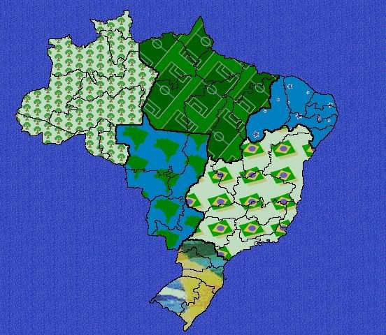
This is the final version for my Brazil map... at least, as I imagined it... from the last update, I added some art, and mainly, added non-crossing borders, making much better the playability (I hope
Central Axis - Asia
Central North - Europe
Northwest - North America
Northeast - Africa
Mato Grosso - South America (more difficult, I know)
South - Oceania
Well, maybe some routes can disappear yet... maybe between Alagoas and Salvador, what do you think? Another routes?
Second, armies bonus for the continents. My suggestions, after the modifications:
Central Axis - 8
South - 2
Mato Grosso - 3
Northeast - 3
Central North - 5
Northwest - 5
The visualization is good, in my opinion. Do you see any problems? Maybe Northeast frontiers (they are covered), but I think they are pretty obvious. Suggestions?
What more should be changed?
And, I am having trouble in resizing the image... so, if anyone can help me, I will be very happy.
And thanks to all that feedback me!!


 _________


