 all i did was make it bigger. i have not addressed such other urgent issues such as the koala
 South Africa [I'll come back to it eventually] [Vacation]
Moderator: Cartographers
Forum rules
Please read the Community Guidelines before posting.
Please read the Community Guidelines before posting.
-
happysadfun

- Posts: 1251
- Joined: Mon Jul 10, 2006 9:06 pm
- Location: Haundin at DotSco, Being Sad that Mark Green Lost in Suburban Wisconsin
-
happysadfun
- Posts: 1251
- Joined: Mon Jul 10, 2006 9:06 pm
- Location: Haundin at DotSco, Being Sad that Mark Green Lost in Suburban Wisconsin
-
gavin_sidhu

- Posts: 1428
- Joined: Mon May 22, 2006 6:16 am
- Location: Brisbane, Australia
-
happysadfun
- Posts: 1251
- Joined: Mon Jul 10, 2006 9:06 pm
- Location: Haundin at DotSco, Being Sad that Mark Green Lost in Suburban Wisconsin
-
happysadfun
- Posts: 1251
- Joined: Mon Jul 10, 2006 9:06 pm
- Location: Haundin at DotSco, Being Sad that Mark Green Lost in Suburban Wisconsin
-
happysadfun
- Posts: 1251
- Joined: Mon Jul 10, 2006 9:06 pm
- Location: Haundin at DotSco, Being Sad that Mark Green Lost in Suburban Wisconsin
-
happysadfun
- Posts: 1251
- Joined: Mon Jul 10, 2006 9:06 pm
- Location: Haundin at DotSco, Being Sad that Mark Green Lost in Suburban Wisconsin
-
gavin_sidhu
- Posts: 1428
- Joined: Mon May 22, 2006 6:16 am
- Location: Brisbane, Australia
...wow. That is much bigger. What program are you using? I think your going about creating the map all wrong. What i did with my pathetic Indian map (which wont be pathetic for two much longer i hope) is got a map of the area, and cleared all its colouring so it just had borders, and then i attempted to deorate it.
http://en.wikipedia.org/wiki/Image:Sout ... l_2006.png
Take this image (you can steal it because it is only licensed under GNU), get rid of the numbers I would make the borders black and then start working on it. It will look much better than ur current paint job. (love the mountains btw).
The only problem with this is that you wont have surrounding countries, but you could draw them in later if you want.
Highest Score: 1843 Ranking (Australians): 3
-
happysadfun
- Posts: 1251
- Joined: Mon Jul 10, 2006 9:06 pm
- Location: Haundin at DotSco, Being Sad that Mark Green Lost in Suburban Wisconsin
-
gavin_sidhu
- Posts: 1428
- Joined: Mon May 22, 2006 6:16 am
- Location: Brisbane, Australia
What program are u using? If u dont have photoshop (which is apparently the best, i wouldnt know im not rich enough to afford it) or any other programs u have to pay for, download GIMP (I spent ages trying to use Inkscape and it didnt work for me, GIMP was much more friendly). There are a lot of help pages for it, i learnt how to use it from this website.
http://www.gimphelp.org/index.html
http://www.gimphelp.org/index.html
Highest Score: 1843 Ranking (Australians): 3
-
happysadfun
- Posts: 1251
- Joined: Mon Jul 10, 2006 9:06 pm
- Location: Haundin at DotSco, Being Sad that Mark Green Lost in Suburban Wisconsin


-
reverend_kyle

- Posts: 9250
- Joined: Tue Mar 21, 2006 4:08 pm
- Location: 1000 post club
- Contact:
-
happysadfun
- Posts: 1251
- Joined: Mon Jul 10, 2006 9:06 pm
- Location: Haundin at DotSco, Being Sad that Mark Green Lost in Suburban Wisconsin
reverend_kyle wrote:If my eyes could stand to look at it i'd give feedback.. I say use gavins image and make lesotho one territory that isnt in a continent like the quad.
i started already but lesotho's grayed out
Marvaddin wrote:Hmmm, magnification error... I still cant see the map.By the way, I use 800x600. Can you post an image with the size of one CC normal map??
is that close enough? i couldn't get it much smaller otherwise it would be thumbnail-ish.
 Children, this is what happens to hockey players, druggies, and Hillary Clinton.
Rope. Tree. Hillary. Some assembly required.
-
lilwdlnddude

- Posts: 302
- Joined: Wed Feb 01, 2006 8:26 pm
- Gender: Male
- Location: Earth
gavin_sidhu wrote:What program are u using? If u dont have photoshop (which is apparently the best, i wouldnt know im not rich enough to afford it) or any other programs u have to pay for, download GIMP (I spent ages trying to use Inkscape and it didnt work for me, GIMP was much more friendly). There are a lot of help pages for it, i learnt how to use it from this website.
http://www.gimphelp.org/index.html
Oh, photoshop is the best, well atleast the latest version is. And I did a little research on gimp, its a pretty good program from what ive read. Ill have to try it out.
Where's Waldo?!
-
happysadfun
- Posts: 1251
- Joined: Mon Jul 10, 2006 9:06 pm
- Location: Haundin at DotSco, Being Sad that Mark Green Lost in Suburban Wisconsin
-
cowshrptrn

- Posts: 838
- Joined: Thu Aug 17, 2006 1:15 pm
- Location: wouldn't YOU like to know....


-
happysadfun
- Posts: 1251
- Joined: Mon Jul 10, 2006 9:06 pm
- Location: Haundin at DotSco, Being Sad that Mark Green Lost in Suburban Wisconsin

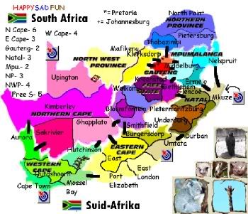
Good day everybody.
I'm a relatively new subscriber and I was thinking about a South African map, when I stumbled onto this thread.
This original idea seems to have died down, but I would like to revive it.
The last two evenings I whipped this up, using my relatively amateur graphic design skills:

The map is loosely based on the Wikipedia map of the SA districts.
Please tell me if I'm wasting my time, but I would dearly like to make this map...
I'm a relatively new subscriber and I was thinking about a South African map, when I stumbled onto this thread.
This original idea seems to have died down, but I would like to revive it.
The last two evenings I whipped this up, using my relatively amateur graphic design skills:
The map is loosely based on the Wikipedia map of the SA districts.
Please tell me if I'm wasting my time, but I would dearly like to make this map...


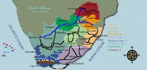
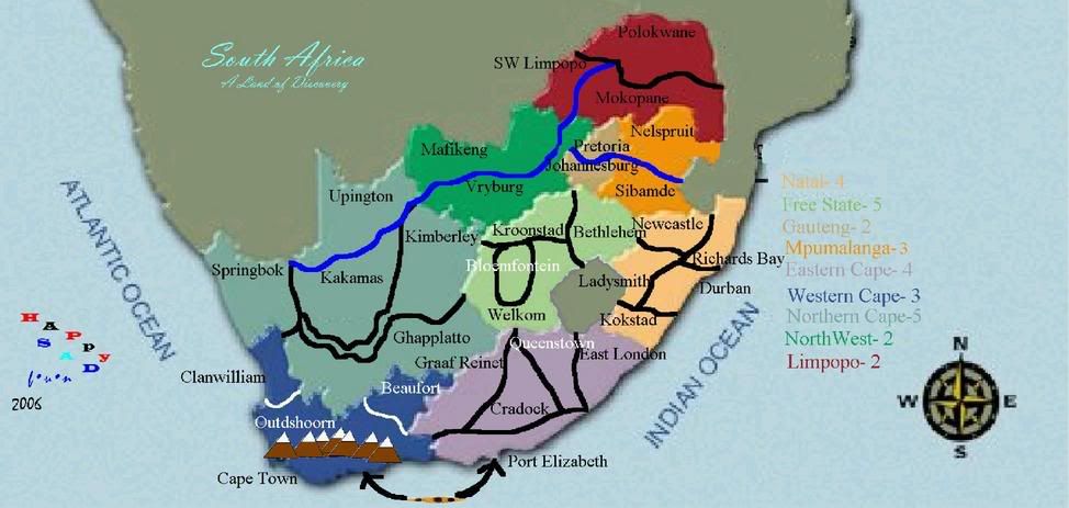
yeti_c wrote:Looks pretty good - you may need to block a few borders here and there as the middle "continents" will be hard to hold...
Also I can't tell which territories the Harbours relate to...
C.
Obviously the rivers and mountains are unpassable. Rivers can only be crossed by bridges.
I could probably add a river or another mountain here and there. Give me some ideas if you have.
Input is what I need!
Updated map, also with army shadows:
-
Nikita_2006
- Posts: 486
- Joined: Thu Oct 19, 2006 8:35 am